Click to view article in PDF format (~1.8 mb).
![]() Fracture
Fracture![]() Modeling in a Dual
Porosity Volcaniclastic Reservoir: A Case Study of the Precuyo Group in Cupen
Mahuida field, Neuquén, Argentina*
Modeling in a Dual
Porosity Volcaniclastic Reservoir: A Case Study of the Precuyo Group in Cupen
Mahuida field, Neuquén, Argentina*
By
Martin Zubiri1 and José Silvestro1
Search and Discovery Article #20045 (2007)
Posted September 3, 2007
*Adapted from extended abstract prepared for presentation at AAPG Annual Convention, Long Beach, California, April 1-4, 2007
1Repsol YPF, Neuquén, Argentina ([email protected])
The synrift deposits of the Precuyo Group in the Cupén Mahuida gas field consist of a large succession of massive and fragmented volcanic rocks and volcaniclastic sediments of Late Triassic to Early Jurassic age. Structurally the field consists of an E-W-trending anticline, vergent to the south, developed during Upper Jurassic and Lower Cretaceous times by oblique inversion of prior half-grabens.
Build-up tests define a dual porosity system reservoir, where the pore space is divided into two distinct media: the matrix, with high storability and low permeability, and the fractures with high permeability and low storability. Interpretation of image logs closely relates best productive zones with open fractures.
Open fractures tend to be
organized in clusters as they show lithology dependency. Three sub-vertical
systematic sets were defined. The most dominant appear to be aligned with the
present day tectonic stress in a NW-SE direction. The other two sets (NE-SW and
E-W) seem to respond to local ![]() fracture
fracture![]() swarms. From seismic interpretation,
three sets of faults were recognized: E-W, N20, and N120. The fractal dimension
of each set was used to model sub-seismic faults and the associated damage
zones.
swarms. From seismic interpretation,
three sets of faults were recognized: E-W, N20, and N120. The fractal dimension
of each set was used to model sub-seismic faults and the associated damage
zones.
A discrete ![]() fracture
fracture![]() network was
generated, where realistic simulation is constrained to match well and seismic
data.
network was
generated, where realistic simulation is constrained to match well and seismic
data. ![]() Fracture
Fracture![]() distribution allowed the definition of new deviated wells with an
azimuth of 205° and a dip of 45° to optimize
distribution allowed the definition of new deviated wells with an
azimuth of 205° and a dip of 45° to optimize ![]() fracture
fracture![]() frequency.
frequency.
![]() Fracture
Fracture![]() assessment opened a new insight to well planning. As a result new structural
plays are depicted, and new well locations pointed out.
assessment opened a new insight to well planning. As a result new structural
plays are depicted, and new well locations pointed out. ![]() Fracture
Fracture![]() density and
interception probability is estimated to optimize best production results.
density and
interception probability is estimated to optimize best production results.
|
|
For the past half-decade the deep gas discoveries in synrift deposits of the Neuquén basin have initiated a series of studies regarding reservoir characterization of volcanic and volcaniclastic rocks. To date no geological model has been able to characterize reservoir quality or predict the presence of hydrocarbons. From nearby locations (800 m), wells show anomalous productions. Initial rates may vary between 500,000 and 100,000 m3/d, or show no production at all. With reservoir thickness beneath seismic resolution, trace inversion contribution has been misleading. Although the matrix plays a decisive role in reservoir response, core information, borehole image logs interpretation, and well completion show that fractures often define reservoir productivity. Furthermore, build-up tests show a dual porosity system, in which poor matrix permeability relay on natural fractures to carry out hydrocarbons.
A workflow is proposed using FRACA, a
Beicip-Franlab software, to generate a discrete
Placing a discrete
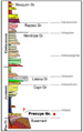
Geological Framework The Cupén Mahuida field is located in the Loma La Lata - Sierra Barrosa area, 100 km west of Neuquén city, in the western portion of central Argentina (Figure 1). It produces gas from the Precuyo Group (Figure 2), a succession of volcanic and volcaniclastic rocks of variable thickness, covering an area of 70 km2 (Pángaro et al., 2002).
During Late Triassic to Early Jurassic
times, the Neuquén basin went through an extensional A following sag stage is represented by the Los Molles Formation. The lower section of this unit, a 400 m succession of black shales, records the first marine ingression to the basin. The shales from Los Molles constitute the regional seal as well as the source rock of the petroleum system (Veiga et al., 2001). The overlying sedimentary units are beyond the scope of this paper. Regional studies can be found in Uliana and Legarreta (1993), Legarreta et al. (1999), Vergani et al. (1995). A period of compressive deformation took place along with this sag stage, giving birth to a series of structural trends related to the formation of the Huincul High, where wrench-dominated tectonics, oblique inversion of half-grabens, and basement-related lineaments without influence of previous extensional features, were developed.
Under this tectonic
Main Reservoir Features The Precuyo group in the study area can be divided into two sections. Although they both show very similar composition and lithology variations, the upper one has proven to host the best reservoir rocks and gas production. It consists of a 300-m succession of stratified and massive tuffs. In space, these tuffs defined as pyroclastic flows, form overlapping lenses with strong lateral variations, often restricted to an area not larger than 1 km2. Rocks from the upper section are defined as acid volcanic rocks (fenodacites) of Late Triassic to Early Jurassic age. The geochemical composition of these rocks (> 63% SiO2) defines them as subalkaline acid rocks from the calco-alkaline series. The strong alteration makes it difficult to distinguish between lava or pyroclastic flows due to the host of textural features. Hydrothermal alteration was caused by the circulation of hot fluids (150°C – 300°C) with neutral pH, and controlled by permeable zones, generating secondary matrix porosities on the order of 12 to 15%. The presence of micro-fractures and micro-breccias (hydraulic fractures) in porous levels inside the tuffs is associated with both hydrothermal alteration processes and low-temperature sea-water-contact deposition. Productive intervals show a corrected gas permeability of 10 mD, corrected effective porosities of 9 to 12% and gas saturations (Sxo) of 30 to 40 %. The rest of the column shows poor permeability and porosity values (0.0001 mD – 0.5%). A well core, image log and thin section can be seen in Figure 3.
Theoretically, Seismic data constrains (amplitude and acoustic impedance) combined with well logs interpretation and correlation, in addition to a detailed cutting analysis for each of the present wells, were used to define eight volcanic and clastic facies for the Upper Precuyo Group. These are: massive pyroclastic flows (tuffs) - stratified pyroclastic flows (tuffs and chonites) - breccias of pyroclastic flows - lava flows – sandstones - shales - volcanic sandstones - upper chonites. Lateral correlation of the mentioned facies resulted in a complex stratigraphy and a 2D facies modeling between wells (Figure 4). 3D modeling could not be done due to the poor seismic data quality and strong lateral variations. For practical purposes, a three-layered model consisting of three units and facies was built to constrain lithology distribution, mainly bed thickness. Despite the lack of a solid facies model, there are a few considerations to be made here.
The continuity of fractured reservoirs
cannot be defined by means of lithology distribution. This means
that it is not possible to trace the reservoir (or fractured layers)
outside the perimeter of the well. Neither can its position be
defined in the stratigraphic column. In contradiction to what we are used to expect, thinner and stratified beds concentrate less fractures than thicker and massive ones. Therefore reservoirs rocks are dominated by massive tuffs, breccias, and volcanic flows.
Seismic Fault Analysis
Major fault geometries and distribution
can be interpreted directly from seismic data. However, smaller
faults beneath seismic resolution need to be modeled in a different
way. If seismic faults show fractal behaviour, synthetic sub-seismic
faults can be reproduced via stochastic modeling, constrained with
Three sets of seismic faults were defined from seismic data: E-W, N20, and N120. The fractal dimension of each set, together with maps with similarity with reference to distance to faults, curvature, and acoustic impedance, were used to model sub-seismic faults.
A
A multi-well analysis was made for five wells. Open and semi-open fractures interpreted in image logs are characterized in this section. All fractures are defined as systematic joints and sorted out in four sets according to their dip and azimuth: E-W, N20, N120, and sub-horizontal. Mean dip, dip-azimuth, and average true spacing values are obtained from a statistical analysis. Closed fractures should be analyzed as well. In the present case we could not find a clear relation between wells and closed fractures, and therefore they were discarded for the analysis.
Well analysis allows us to quickly
visualize and correlate fractured zones with productive zones and/or
lithology. For most of our wells, we observed a close correlation
between
Geomodel
For the input model we defined three units
that represent three different structural facies of the upper
Precuyo Group, based on
Static Model
Once we define all systematic and
sub-seismic sets, we can start modeling the
Seismic attribute maps are used to
constrain
Network simulations are first done in
cells that contain the wells. A cell represents the minimum unit of
volume defined by the user. For this work each cell covers an area
of 120 x 120 meters. In this way we can assure that non-conditioned
simulations are comparable to real well data. This is measured by
comparing the number of fractures intercepted in each well for a
conditioned and non-conditioned simulation. When this number is
similar, we assume we have obtained a correct
From well analysis we have established a
preferential direction for open and semi-open fractures and break
outs. This direction has an azimuth of 130° and corresponds to the
present-day maximum tectonic stress. From this perspective we
simulate vertical and deviated wells with an azimuth of 220° to
estimate a comparative percentage of intercepted fractures. The
number of fractures increases as we move towards a horizontal well (Figure
9). With a deviation of 30° the number of fractures intercepted
is increased by 63% with respect to a vertical well; with 45° it
rises to 130%, and with 60° up to 300%. Since we are not able to
define where fractures will appear, the angle of deviation must take
this into account. A horizontal well is therefore not
recommended--but a well with an angle of 45° which increases the
chances of finding the
Results Obtained from Deviated Well
From the multi-well analysis we can see
that sub-vertical fractures are practically missing on vertical
wells. Even though we might be able to estimate their frequency (Terzaghi),
this is not very precise. The proposed and drilled deviated well on
the other hand, has its mean
A dual porosity system is proposed for the Precuyo reservoirs, in which the presence of open fractures substantially increases productivity and reservoir quality. Sub-seismic faults patterns were obtained via stochastic modeling of major fault fractal dimensions, helping the definition of new structural plays and well locations. Three sets of systematic fractures were defined from well image logs. The most dominant (N120) appears aligned with the present day maximum tectonic stress. The other two (N20 and N90) are associated with major fault geometries. Fractures appear organized in clusters and constrained to massive lithologies: tuffs, breccias, and lava flows.
A Discrete
The model was tested with an infill well
which is actually being tested.
Bourbiaux, B., Basquet, R., Daniel, J.M., Hu, L.Y., Jenni, S., Lange, A., Rasolofosaon, P., 2005, Fractured reservoirs modeling: a review of the challenges and some recent solutions: First Break, v. 23, S33-S40. Cacas, M.C., Daniel, J.M., Letouzey, J., 2001, Nested geological modeling of natural fractured reservoirs: Petroleum Geoscience, v. 7, S43-S52. Gulisano, C., 1981, El ciclo Cuyano en el norte de Neuquén y sur de Mendoza: VIII Congreso Geólogico Argentino, v. III, p. 579-592. Legarreta, L., Laffitte, G., and Minniti, S., 1999, Cuenca Neuquina: Múltiples posibilidades en las series Jurásico- Cretácicas del depocentro periandino: Actas del III Congreso Nacional de Exploración de Hidrocarburos, 1, p. 145-175. Mar del Plata, Argentina. Pángaro, F., Corbera, R., Carbone, O. and Hinterwimmer, G., 2002, Los reservorios del Precuyano, in Schiuma, M., Hinterwimmen, G., and Vergani, G., eds., Rocas Reservorio de las Cuencas Productivas Argentinas, p. 229-254. Peacock, D.C.P., and Mann, A., 2005, Evolution of the controls on fracturing in reservoir rocks: Journal of Petroleum Geology, v. 28, p. 385-396. Uliana, M. and Legarreta, L., 1993. Hydrocarbons habitat in a Triasic-to-Cretaceous sub-Andean setting: Neuquen Basin, Argentina: Journal of Petroleum Geology, v. 16, p. 397-420. Veiga, R., Hechem, J., Bolatti, N., Agraz, P., Sánchez, E., Saavedra, C., Pángaro, F., García, D., and Moreira, E., 2001, Synrift deposits as a new play concept in the central portion of the Neuquén basin: Future perspectives from the analysis of physical models: Hedberg Conference AAPG, Mendoza, November, 2001. Program with abstracts. Vergani, G., Tankard, A., Belotti, H., and Welsink, H., 1995. Tectonic evolution and paleogeography of the Neuquen Basin, Argentina, in Tankard, A., Suárez, R., and Welsink, H., eds., Petroleum Basins of South America: AAPG Memoir 62, p. 383-402.
|