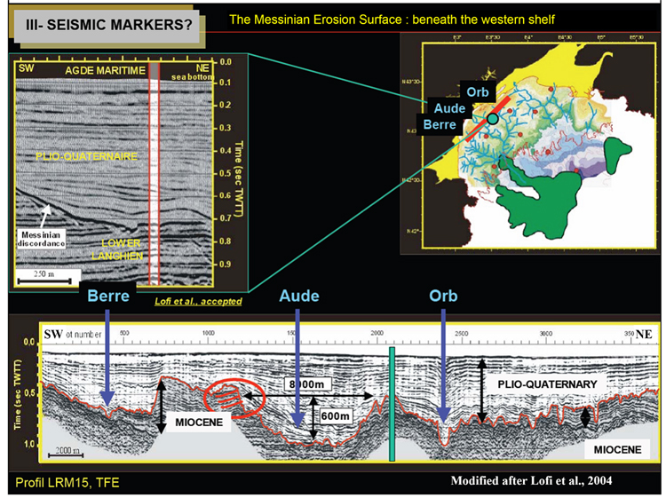
Figure 5M-1. Messinian desiccation is recorded in up-dip locations where canyons and incised valleys were created. The Messinian erosion surface beneath the western shelf: Part of seismic line (upper left) in detail; map of surface (upper right), with location of detailed segment of seismic line along with location of complete line (from Lofi et al., accepted); complete seismic line modified after Lofi et al., 2004).