Click on image to view enlargement.
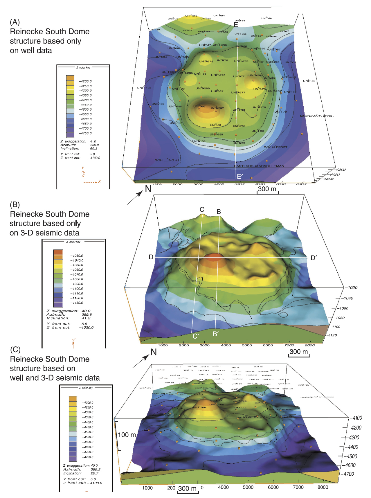
Figure 5. Structure of the top of carbonate, south dome of Reinecke field. All views are from the southeast. Vertical exaggeration is 4X. (A) Map (in ft subsea) based solely on well data. (B) Seismic two-way traveltime map (in ms). (C) Map (in ft subsea) based on well and 3-D seismic data.