Click on map or seismic line to view enlargement.
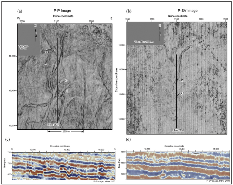
Figure 2. Map
views of thin stratigraphy (a) and (b), used to depth register P-P and P-SV
images. In map view, equivalence of thin P-P and P-SV channel features results
in P-SV time 1,964 ms (b) being defined to be depth equivalent to P-P time 796
ms (a). It is more difficult to determine depth-equivalent image coordinates
using 2-D section views (c) and (d) of this same stratigraphy. Horizontal yellow
lines across the section views define the positions of the time slices. The
vertical sections are positioned along inline coordinate 2100. Channel features
A through F on the map views are the same features labeled A through F on the
vertical sections.