Geomorphic Response of the Henrys Fork River to Pleistocene Volcanism, Mesa Falls Recreation Area, Caribou-Targhee National Forest, Idaho*
Clayton S. Painter1,
![]() William
William![]() W. Little2,
Glenn F. Embree2,
and Mark Millard2
W. Little2,
Glenn F. Embree2,
and Mark Millard2
*Poster Presentation at
Rocky Mountain Section AAPG Annual Meeting, Jackson, Wyoming, September 24-26,
2005. Appreciation is expressed to Lyn George, Technical Program Chair, and Don
![]() French
French![]() , for encouraging the authors to submit this presentation.
, for encouraging the authors to submit this presentation.
![]() Click
to view poster in PDF format.
Click
to view poster in PDF format.
Abstract
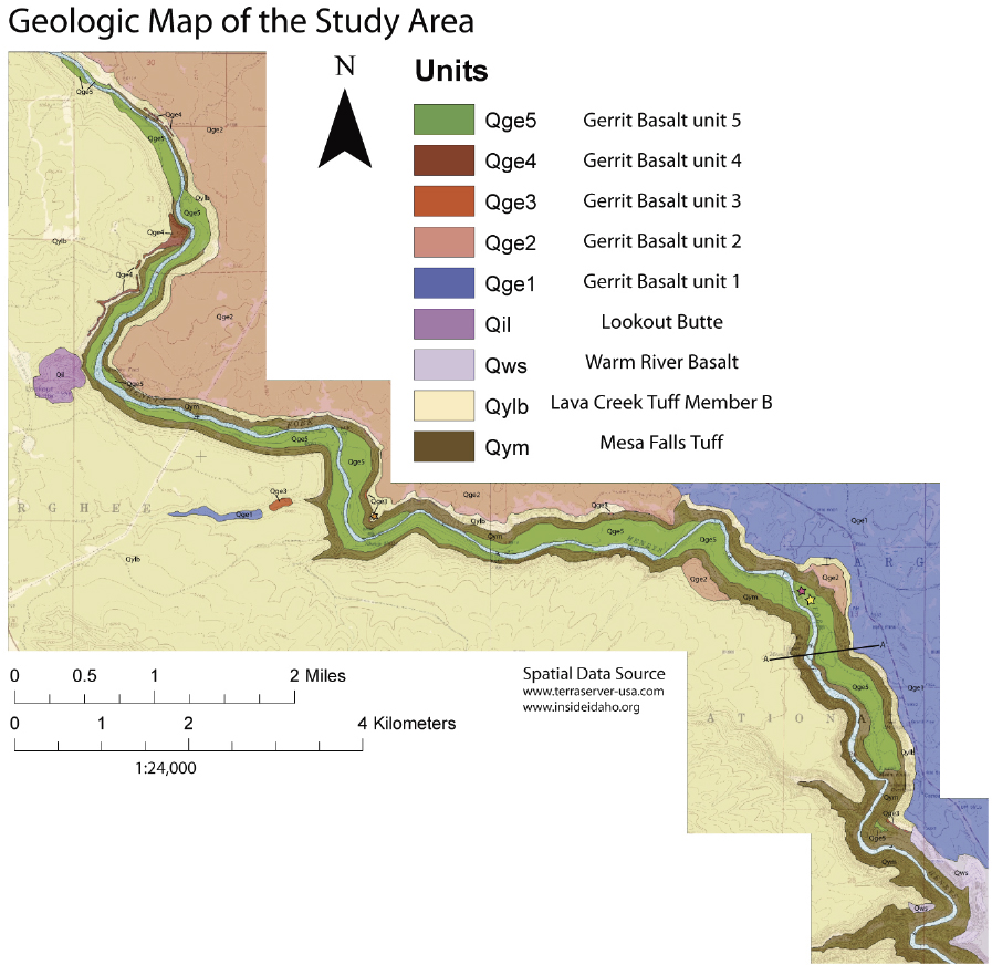
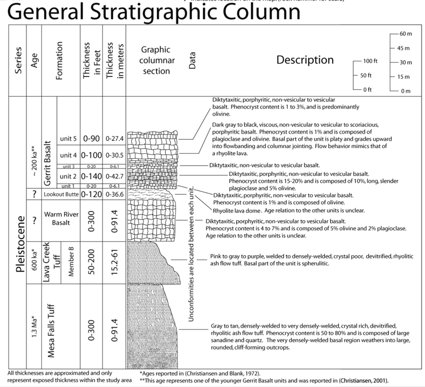
The Mesa Falls Recreation Area, located approximately 16 kilometers northeast of Ashton, Idaho, consists of Pleistocene volcanic units, including the Mesa Falls and Lava Creek Tuffs of the Yellowstone Group and the Gerrit Basalt. On occasion, the channel eroded by the Henrys Fork River has been partially to completely filled by basalt flows, producing multigenerational terraces as the Henrys Fork entrenched along the margins of the flows. Differences in erodibility of the tuffs and basalt seems to be the primary control on the present course of the Henrys Fork River and will likely continue to influence future migration. An inverted valley is developing as the Henrys Fork River erodes through the rhyolitic tuff at the edge of the basalt flows. Mapping and correlation of remnant basalt terraces helps to better understand the geomorphic response of river systems to concurrent volcanic activity.