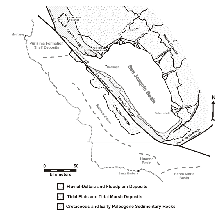
Figure 1. Early Pliocene paleogeography of central California at ~5 Ma (this study and in part modified from Foss, 1972; Harris, 1987; Loomis, 1990). Faults west of the San Andreas fault are not shown. By this time the Sierra Nevada, San Emigdio Range, Temblor Range, and Diablo Range had been uplifted to near present elevations (Wakabayashi and Sawyer, 2001; Argus and Gordon, 2001). Locations of Purisima Formation and Salinas, Huasna, and Santa Maria basins are shown relative to the San Joaquin Basin at that time. The modern California coastline is shown for reference.