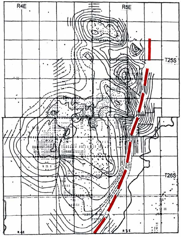
Figure 4. Structural contour map, on top of eroded Ordovician, of the giant El Dorado oil field, in Butler County, Kansas (from Reeves, 1929). Contour interval 50 feet. It is a typical transpressional (“pop-up”) structure, about 15 miles long and 9 miles wide. It is bounded on the east by the Nemaha fault, which was not mapped—following the accepted procedure for contouring at the time this map was prepared. “Cherokee” (Middle Pennsylvanian) strata overlie the eroded Cambro-Ordovician Arbuckle.