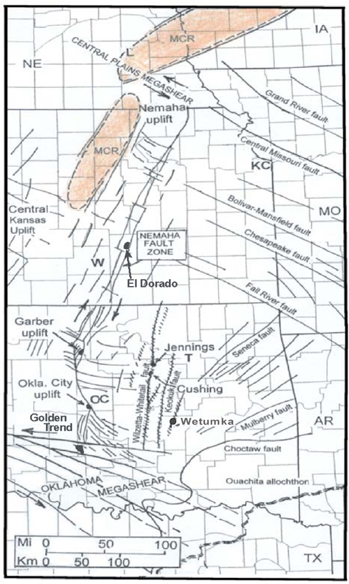
Figure 1. Generalized fault framework of the area encompassing the Nemaha zone, which lies between, and is terminated by, two northwest-trending, left-lateral megashears, the Central Plains (to the north) and the Oklahoma (to the south). En echelon, northwest-southeast surface faults east of the Nemaha zone in Oklahoma form north- to north-northeast-trends (Miser, 1954). The Nemaha zone and the other fault trends are sites of many productive structures, which originated by strike-slip movements. Trace of the Nemaha fault adapted from Berendsen and Blair (1992). L= Lincoln; KC= Kansas City; OC= Oklahoma City; T= Tulsa; W= Wichita.