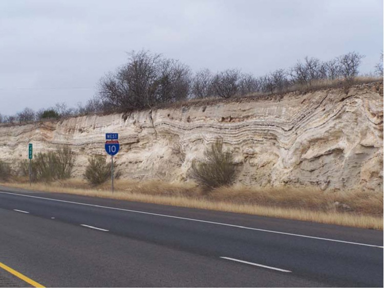
Figure 2. Outcrop photograph of exposures along the north side of the westbound lanes of I-10, illustrating some of the compressional structures formed as a result of caliche precipitation. Note mile marker 484 sign for location reference.
Figure 2. Outcrop photograph of exposures along the north side of the westbound lanes of I-10, illustrating some of the compressional structures formed as a result of caliche precipitation. Note mile marker 484 sign for location reference.