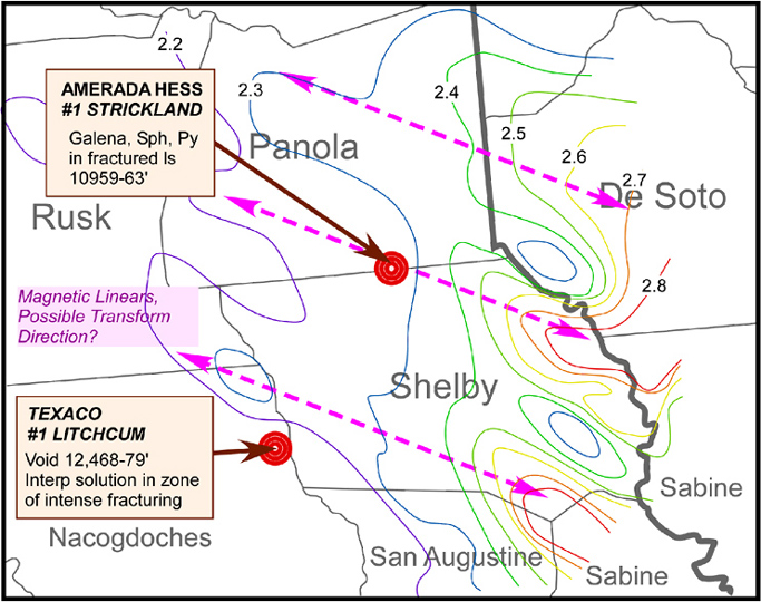
Figure 4. Geothermal gradient contours, magnetic linears, and two wells with evidence of hydrothermal alteration in the Shelby County area. Gradient contours shown are degrees Fahrenheit per 100 ft (e.g., 2.8°F / 100 ft = 51°C / km) from bottom-hole temperature data.