Click on image for enlargement.
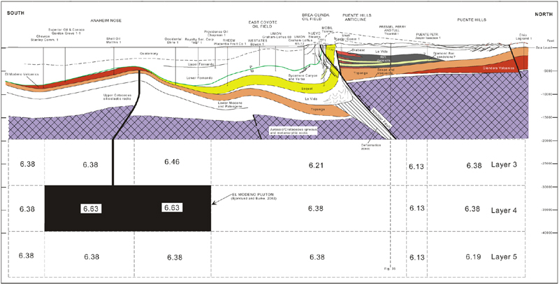
Figure 36. Anaheim nose to East Coyote oil field, Brea-Olinda oil field and the Puente Hills. The cross section shows possible spatial relationships of volcanic rocks (red) and their upper crustal source (solid black) based on an integrated interpretation of well and outcrop data and tomographic velocities. The higher-velocity tomographic anomalies have been interpreted to reflect the presence of a vertical, sill-like pluton here named the El Modeno pluton. The pluton would have been emplaced into the upper crust during the Miocene and acted as magma source for volcanic rocks. Rock with a bulk density of ca. 2.9 gm/cc and dioritic composition would correlate with the average block velocity (6.6 km/s) of the pluton (Birch, 1960). The exact shape of the pluton cannot be resolved with the grid-spacing of the velocity model of 10x10x3 km. Dashed rectangles are velocity-model grid blocks with average P-wave velocities (km/s) shown (After Zhou, 1994) (See Bjorklund et al., 2002 for additional details.). (See Figure13 for a large-scale cross section of this part of Brea-Olinda oil field and this segment of Whittier fault, along with associated faults.)