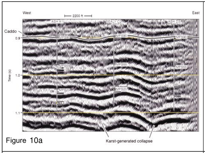
Figure 10a. Profile along Line A of Figure 9, showing how the Sealy C-2 Caddo reservoir is structurally compartmentalized by surrounding Ellenburger-related karst collapse zones. MFS90 means “maximum flooding surface 90,” and is the position of the sequence boundary for the top of the Caddo. MFS55 is the top of the Bridgeport; MFS20 is the top of the Vineyard. Step changes show where zones were perforated.