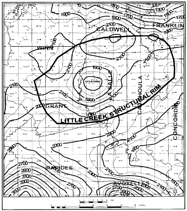
Figure 3 - Upper Cretaceous isopach map (100 ft contour interval) illustrating the structural rim around the Little Creek structure and thinning from the rim onto the central area of the structure.
Figure 3 - Upper Cretaceous isopach map (100 ft contour interval) illustrating the structural rim around the Little Creek structure and thinning from the rim onto the central area of the structure.