Click on image for enlargement.
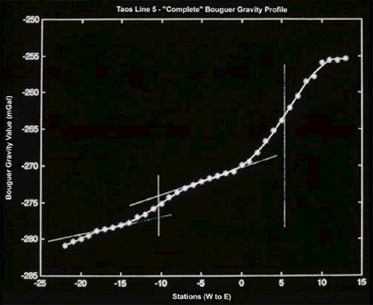
Figure 7. Taos Valley, Bouguer gravity profile defining a buried fault that influences ground-water movement. The sharp inflection at the right (east) end of the Bouguer gravity profile marks a buried fault with no surface expression; displacement measures thousands of feet. (NM Bureau of Geology and Mineral Resources, 2000).