Click on image for enlargement.
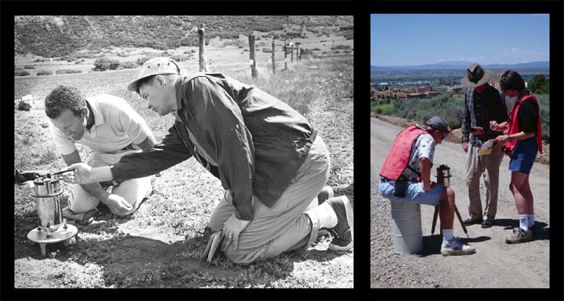
Figure 5. Taos Plateau, NM, geophysical methods, specifically gravimetric surveys. Training in gravity data acquisition to delineate buried structures began in 1999. Gravimetric surveying is nondestructive and requires no external energy input; the instrument is lightweight, portable, and flight-certified. L - Gordon Cooper and Marty Kane read gravimeter, Apollo field training (Schaber, 2002). R - Chris Ferguson, John Young, and Barbara Morgan collect gravity and GPS data.