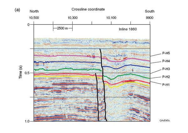
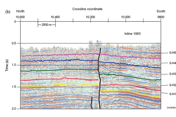
Figure 1. (a) P-P image, and (b) P-SV image across shallow, gas-charged sediments in the Gulf of Mexico. P-P horizons P-H1 through P-H5 are interpreted to be depth equivalent to P-SV horizons S-H1 through S-H5. The P-SV data image stratigraphy inside the P-wave wipeout zone extending from CDP coordinates 10,000 to 10,150.