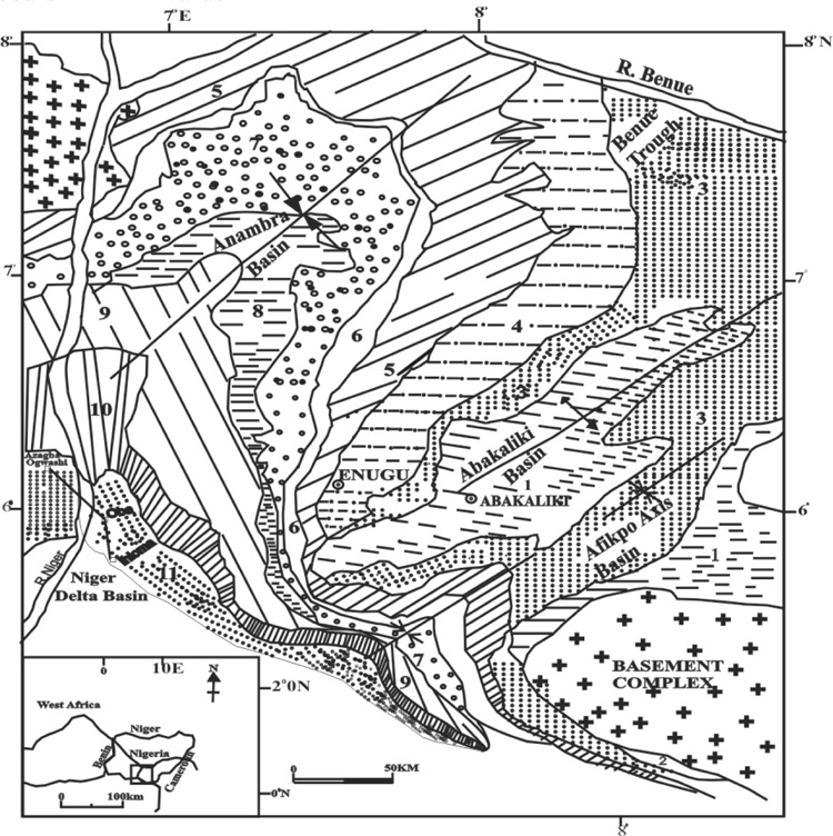
Figure 1. Generalised geological map of southeastern Nigeria (boxed area of inset) showing the location of the Cretaceous to Tertiary sequences north of the Niger Delta Basin. Numbers of the formations as follows: 1. Asu River Group; 2. Odukpani Formation; 3. Eze-Aku Shale; 4. Awgu Shale; 5. Enugu/Nkporo Shale; 6. Mamu Formation; 7. Ajali Sandstone; 8. Nsukka Formation; 9. Imo Shale; 10. Ameki Formation; 11. Ogwashi Asaba Formation. The Anambra Basin study traverse from Azagba-Ogwashi to Ihioma is shown on the southwest side.