Click to view poster in PDF format (~7.0 mb).
For easier viewing, Right click and save file to hard drive.
PSFractured Basement: New Exploratory Target in La Concepcion Field, Western Venezuela*
By
Jesus S. Porras1, Carlos E. Ferro2, Carla Castillo3, Vanessa Machado3, Luis Ochoa3, Nelson Chirinos3, and Fernan Perez3
Search and Discovery Article #10140 (2007)
Posted November 20, 2007
*Adapted from poster presentation at AAPG Annual Convention, Long Beach, California, April 1-4, 2007
1Petrobras Energía Venezuela, Maracaibo ([email protected])
2Petrobras Energía Venezuela, Caracas ([email protected])
3Petrowayuu Filial de PDVSA, Maracaibo ([email protected])
In Western Venezuela, production from naturally fractured basement has been known for decades. Since El Totumo, Limon and giant Mara-La Paz oilfields discoveries in the early twentieth century, new commercial oil production from basement had not been reported in years. In the 1960-decade, unsatisfying results were obtained searching for oil from basement in El Mojan, Sibucara, Los Lanudos, and La Concepcion fields. In La Concepcion field, evidence in some wells suggested the existence of basement as a producing reservoir.
However, a combination of factors including: operational problems that impeded production testing, the experience of having dry basement in some former wells and the insignificant production obtained in the only well where basement was proved--when compared to its Cretaceous production--prevented further pursuit of basement as a commercial target.
Nevertheless, it was not until 2004 when commercial production from basement was obtained through well C310, initially producing at 4600 bopd. Further drilling continued basement development; well C313 was completed in July 2004, producing 3915 bopd, and well C314 was completed in November 2004, producing 3714 bopd. Recently, in 2006, well C325 also confirmed basement production.
This poster aims to describe the main characteristics of fractured basement in La Concepcion field. Also, it is intended to evaluate the reservoir under a new perspective, in order to determine its potential, after exploration, and further studies and analyses.
As a result, additional opportunities could be obtained, and as a consequence, hydrocarbons reserves would be increased.
|
|
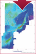
La Concepcion field is located approximately 20 km west of the city of Maracaibo, in the northwestern Maracaibo Basin, Venezuela. Discovered in 1924, the field produces from two main reservoirs: a siliciclastic reservoir currently depleted (Eocene) and a naturally fractured carbonate reservoir (Cretaceous). At present, combined cumulative production is over 170 MMbbl of light oil. An interesting volume of oil has been produced from basement in the last three years. Nearly five million barrels of produced oil are accredited to basement reservoir. Production of Cretaceous reservoirs is attributed to massive fracturing and assuring that increase close to faults. Basement producing wells are located instructural highs (pop-up structures), on central and southern areas of the field and are related to secondary minor faults linked to major bordering faults.
La Concepcion Basement Facts
The stratigraphic column encompasses passive margin carbonate sediments (Cretaceous) and a thick foredeep mixed siliciclastic-carbonate sequence (Paleocene-Eocene) overlying the igneous-metamorphic basement, object of this study.
La Concepcion Basement is composed by igneous (granitic) to metamorphic rocks (gneiss) and is mainly composed by crystalline or milky quartz, pink or orange feldspar, biotite and secondary mafic minerals. Oil is stored in fractures.
Figures 3-1 – 3-2
All data presented in this study was obtained from files that contain drilling, mudlogging and operations information from wells. Sample cuttings as well as fragments of cores were used for petrographical and visual description of rocks. Standard analyses were performed to these samples. A visit to the Isla de Toas outcrop was done for a better understanding of the fracturing mechanisms. Literature from nearby- and around the world oil fields was used in order to have a wide picture of reservoirs in fractured basement rocks. For each well, the acquired data was incorporated and displayed in a composite chart that contents: depth of basement, thickness, footage, drilling parameters, hydrocarbon shows, underbalanced drilling information, testing and production data, geological information, visual fracturing and fracture mineralization, and structural position. The chart was used to select and identify the most significant variables for basement reservoir characterisation and for defning the key factors for oil production.
Oil Migration, Sourcing, and Seal Vertical migration due to rock dilatancy, as well as lateral up-dip migration through faults, are the suggested mechanisms responsible to charge reservoirs. (1) Short vertical migration from source rock (La (Luna formation), passing the naturally fractured limestone of Cogollo Group into basement, may be explained by dilatancy phenomena. This hypothesis was proved -and well documented-in Mara–La Paz fields through pressure measurements done in both reservoirs. Particular observations about secondary sealing have been made in La Concepcion field. (2) Lateral migration from longer distances is attributed to horizontal movement through faults and fracture conduits. Lateral migration took place in zones where source rock and fractured limestones are directly in contact with basement. A restricted zone with these characteristics has been identified in the field. Producing wells of basement are located within this zone. Faults and fractures are the main pathways for hydrocarbon migration. Like many of the basement reservoirs of the world, an unconformity is identified above the basement in La Concepcion. All producer wells show calcite-filled fractures acting as a cap-rock, above the productive section of basement. In producing wells, calcite-filled fractures are found once the top of basement has been reached. Oil in basement has been produced in the same area known as producer in overlying sediments (Cogollo Group) and has the same composition. La Luna Formation is believed to be the source rock for both reservoirs.
Thickness of calcite-filled fractures interval can vary from 50 to more than 200 feet. Origin of calcite has not been determined yet, even though it is supposed to come from dissolution and precipitation of calcium-carbonate rich waters of Cogollo Group.
Figures 5-1 – 5-2
Banded–gneissic-structures due to moderate metamorphism have been recognized in sample cuttings. Petrographically, basement is a holocrystalline igneous plutonic rock, with granular hypidiomorphic texture. It is s composed of polycrystalline quartz, less monocrystalline, with strong wavy extinction, crystals of moderate to intensely altered plagioclase and potassic feldspars, moderately kaolinized with wavy extinction, represented by orthoclase, and scarce microcline. The igneous basement (granite, granodiorite) has been described as mottled white and black, light gray, and pink, coarsely crystalline, with clear and milky quartz, white and pink,or orange, feldspar, biotite, and dark minerals (hornblende).
Outcrops of basement occur north of La Concepcion Field in the Isla de Toas area. In this area, basement is very sheared and fractured and is intruded by basalt and rhyolite dikes and sills. Fracturing is the result of intense deformation due to right lateral strike-slip motion of the Oca fault and-or-transpression faulting. The granite of Isla de Toas is stratigraphically and chronologically correlateable with outcrops of the Perijá Range and subsurface samples of deep wells of the basin, including La Concepcion wells. This granite consists of two textural varieties: one is rose colored, very fine-grained with orthoclase feldspar, perthite, quartz and phenocrysts of hematite and magnetite. The other type of granite, gray in color, is characterized by a porphyritic texture, which in local areas is pegmatitic. On weathering, the granite changes from pink to gray and the biotite becomes golden brown. The rock becomes soft and crumbly and is easily eroded. Both granites have been identified in the La Concepcion subsurface. Basement exposure can be used as an excellent analog for reservoir description and fracturing modeling.
Three old wells, all located in the southern structure, have been cored in basement. The total cored length is 69 feet with only 24% of recovery (16’8”), demonstrating the high grade of fracturing.
Figures 6-1 – 6-7, Table 6-1
Formation Water Analysis Chemical analyses have been done to four producer wells in order to characterize basement formation water. There are three main components that help to determine the formation water origin.
1) Basement formation water is enriched in Ca+2, ranging from 12000 to 14000 ppm; even higher Ca+2 content can be found as in well C313 (>30000 ppm), comparable to neighbor fields, Mara and La Paz. 2) Cl-1 content is higher in basement than Cretaceous formation water, ranging from 32000 to 38000 ppm. 3) Lower Na+1 content is common in basement formation water (<9000 ppm).
On average, in La Concepcion field, total dissolved solids and salinities are very similar for both basement and Cretaceous waters, there is not a defined pattern; hence to characterize formation water all chemical parameters must be considered.
Figures 7-1 -7-2, Table 7-1
First well with commercial production was C310 completed in natural flow on December 2003, initially producing at a rate of 4600 bopd. Originally drilled to Cretaceous objectives, the well was decided to explore for hydrocarbon accumulations into basement because of the low displayed potential. Development of basement reservoir continued with drilling the wells C313 and C314, completed in July and November 2004 and initially producing 3915 bopd (C313) and 3714 bopd (C314), raising basement production to a peak of 7500 bopd.
Evidence of oil and gas has been observed in several wells that penetrated basement: increase of gas during drilling and some petroleum production once wells were completed.
The most obvious case could be observed in well C302, which according to a PLT initially taken, 1250 bopd came from basement (33% of the produced petroleum by the well). On the other hand, the cumulative production of 17 and 29 MMbbl of oil from wells C148 and C227, respectively, neighbors of the area, only can be explained with production coming from either basement or Cretaceous reservoir located in the hanging wall of the fault. An identical situation is believed to take place in well C285 in the South structure.
In December 2006, well C325 was drilled on North Cretaceous structure. This well is located in the northern tip of the reservoir and it is structurally lower than the rest of wells of the area. It penetrated approximately 630 feet into basement, produced gas and oil, and showed an important entrance of water that defined a possible oil-water contact. The rest of the wells, structurally higher, presented a low water cut. Crude oil from basement average 36° API (light oil) and seems to be the same type that is in overlying Cretaceous reservoir. Fingerprint analyses from both reservoirs show similar characteristics between crude oil. These results support both the hypothesis that oil found in basement comes from Cretaceous reservoir through fractures, and also, the fact of have been generated by the same source rock (La Luna Formation). Both Cretaceous and Basement reservoirs can be characterized by high decline rates in short periods of time. Production levels become stabilized in values, which in some of the cases, are below economic limit. According to the production history of the wells, evidence of interference between them has not been observed. GOR values have stayed stable from their beginnings, between 500 and 1200 scf/bbl. All wells are actually producing by artificial gas lifting system.
Although production mechanism has not been fair determined, by analogy with North Cretaceous reservoir, basement production mechanisms could be solution gas drive, and fluid and rock expansion.
According to the behavior of production and pressure, a water-driven mechanism has not been observed. Water production in completed wells in basement is relatively low.
Two pressure measurements (wells C310 and C313) were taken once the reservoir was discovered. These values are considered representative of basement initial conditions. A third and last pressure measurement was done in July 2005 in well C314. When comparing initial pressure of basement as to the obtained on the producing Cretaceous reservoir, there is a fall of 250 psi (Original pressure of Cretaceous = 4800 psi). This can be indicative of some type of communication with either overlying Cretaceous reservoir of Cogollo Group, or drainage of some of the wells completed in the Cretaceous that penetrated some producing intervals in basement, such as well C302 where a PLT indicates a significant contribution from basement.
Figures 8-1 – 8-5, Tables 8-1 – 8-4
The basement is drilled near-balance through deviated wells with directional trajectories perpendicular to the strike of fault planes in order to intercept the higher number of fractures. Average inclination of wells is 22°, and can reach more than 45 degrees. Considering most of the wells had initial cretaceous objectives, wells were completed open hole. Drilling results show that 75% of deep wells reached more than one hundred feet into basement. Ten wells have penetrated 500 to 1000 feet. Maximum thickness reached by a well is 1440 feet. The productive section of basement has not been fairly well defined because the difficulty of run image and/or production logs.
Drilling within the basement has been a common practice from several years. Among forty deep wells drilled in the field with cretaceous objectives, twenty-nine reached basement. Only four of these have proved production from the basement reservoir. Two more wells are supposed to have produced a not quantified amount of oil from it, according to production logs.
Figures 9-1 – 9-2, Table 9-1
Key Factors for Basement Production La Concepcion basement reservoir does not differ from most basement reservoirs of the world. Reservoir characteristics as referred by several authors are found in La Concepcion basement. Statistical analyses have established that for producing from basement, the following factors must simultaneously occur:
La Luna/Cogollo Group in Fault Contact with Basement Productive wells are located within the uplifted structures and are related to secondary minor faults linked to the major bordering faults. Fractures develop around the faults. The fractures provide both storage capacity and the fluid-flow pathway in La Concepcion basement reservoir.
Cap-rock or Seal (Calcite-filled Fractures), Cretaceous Basal Sandstones Width of zones with calcite–filled fractures is variable across the field. Presence of massive limestones within basement have been detected in various wells. They may be interpreted as part of faulted blocks.
Hydrocarbon shows Nearness to a source rock or production zone
Figures 10-1 – 10-7, Table 10-1
Analogy with Other Fields The basement reservoir of La Concepcion has the same constraints and characteristics of nearby fields of Western Maracaibo Basin: Mara, La Paz, El Totumo, Limon and Sibucara.
Figure 11-1, Table 11-1
1. Although basement reservoir from La Concepcion field has most of the characteristics of other basement reservoirs of the world, including neighbor oilfields of Mara-La Paz, it is not well known the production and trapping mechanism. 2. Basement production strictly depends on fractures (Secondary porosity/Type 1 reservoir). Hydrocarbons do not flow through another porosity type like cavities or vugs. Neither intergranular or vesicular porosity have been observed. 3. A productive well from basement is obtained when most of the key factors simultaneously occur in the reservoir. 4. In La Concepcion field, basement reservoir is basically conformed by igneous-metamorphic-rocks of acid composition. 5. Pressure levels at initial conditions differ significantly from Cogollo Group to basement reservoir. Nevertheless, current conditions indicate similar pressure levels for both reservoirs, which could be interpreted as a possible communication between these hydrocarbon accumulations. 6. Improvements in geological, seismic and reservoir characterization, have allowed identify basement as a new target in this mature field.
Table 12-1
The authors wish to thank Petrobras Energía Venezuela and Petrowayuu Filial de PDVSA for the approval and permission to publish this paper.
Feo-Codecido, G., Smith, F.D., Aboud, N., and Di Giacomo, Estela. 1984, Basement and Paleozoic rocks of the Venezuelan Llanos basins, in Bonini, W.E., et al., eds., The Caribbean-South American plate boundary and regional tectonics: GSA Memoir 162, p. 175-187. García, J., Gonzalez, G., Leandri, P., Lorin, T., and Reymond, A., 2000, La Paz Field study: Multidisciplinary approach in fractured reservoir characterization and applications to field development: Memorias VII Simposio Bolivariano Exploración Petrolera en las Cuencas Subandinas, Caracas, Venezuela, p. 662-688. Geoscience Limited, 2002, Hydrocarbon production from fractured basement formations: Version 7, 32 p. (www.geoscience.co.uk, accessed December 2006) Guariguata, R.C., 1956, Campos Petrolíferos del Basamento en el Oeste de Venezuela: VI Congreso Venezolano de Ingeniería, Valencia, Venezuela, 27 p. Guariguata, R.C., and Richardson, J.A., 1959, El Basamento en el Oeste del Lago de Maracaibo: III Congreso Geológico Venezolano, Caracas, Venezuela, 28 p. Koning, T., 2003, Oil and gas production from basement reservoirs: examples from Indonesia, USA and Venezuela, in Petford, N., and McCaffrey, K.J.W., eds., Hydrocarbons in Crystalline Rocks: Geological Society of London Special Publications no. 214, p. 83-92. Landes, K.K., Amoruso, J.J., Charlesworth, Jr., L.J., Heany, F., and Lesperance, P.J. 1960, Petroleum resources in basement rocks: AAPG Bulletin, v. 44, p. 1682-1691. LCV S.R.L., Geologia Integrada, 2000, Cuttings study: Internal Report for Perez Companc. Marchal, D., Gonzalez I., Benito, J., and Balseiro, P., 2005, Technologies and exploitation strategies applied to the development of a naturally fractured carbonate reservoir: The Cretaceous Cogollo Group in La Concepcion Field, Maracaibo Basin, Venezuela:2005 SPE Latin American and Caribbean Petroleum Engineering Conference, Rio de Janeiro, Brazil, 20–23 June 2005, SPE Paper # 97384. Nelson, R.A., Moldovanyi, E.P., Matcek, C.C., Azpiritxaga, I., and Bueno, E., 2000, Production characteristics of the fractured reservoirs of the La Paz Field, Maracaibo Basin, Venezuela: AAPG, v. 84, p. 1791-1809. P’an, Ch.-H., 1982, Petroleum in Basement Rocks: AAPG Bulletin, v. 66, p. 1597-1643. Sircar, A., 2004, Hydrocarbon production from fractured basement formations: Current Science, v. 87, 25 July, p. 147-151. Smith, J.E., 1956, Basement reservoir of La Paz-Mara oilfields, Western Venezuela: AAPG Bulletin, v. 40, p. 380-385.
|