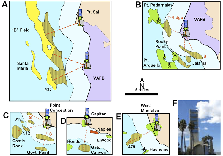
Figure 4.3.
Vertical-lined patterns show unproven OCS reserves within seven
miles of shoreline and possible reserves in state waters (T-Ridge
and S labels). Rig symbols locate six possible onshore drill
sites. The total reserve potential of the six onshore drill
sites ranges from 500 to 1000 MMBOE. The low-side and
high-side recovery factors are 13600 BOE/acre and 33600 BOE/acre
(see Figure 2). The reserve potential of each drill site is:
A. North Vandenberg Air Force Base. 230-470 MMBOE.
B.
South Vandenberg Air Force
Base. 110-220 MMBOE.
C. Pt. Conception. 110-210
MMBOE.
D. Capitan. 30-60 MMBOE.
E.
West Montalvo. 40-90 MMBOE.
F. The drilling rig on the man-made Grissom drilling island
near Long Beach, California is an example of the use of
camouflaging to enhance the visual impact of operations in urban
areas. (Modified from photo by J. Jepson, California DOGGR
website.)