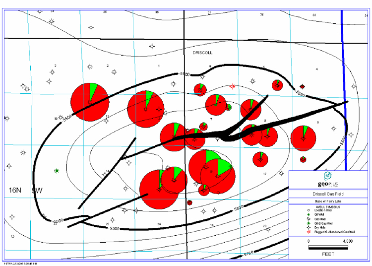
Figure 7. Structure map, base of Lower Cretaceous Ferry Lake, Driscoll field, East Texas, showing pie diagrams to illustrate well-by-well production (oil as green; gas as red).
Figure 7. Structure map, base of Lower Cretaceous Ferry Lake, Driscoll field, East Texas, showing pie diagrams to illustrate well-by-well production (oil as green; gas as red).