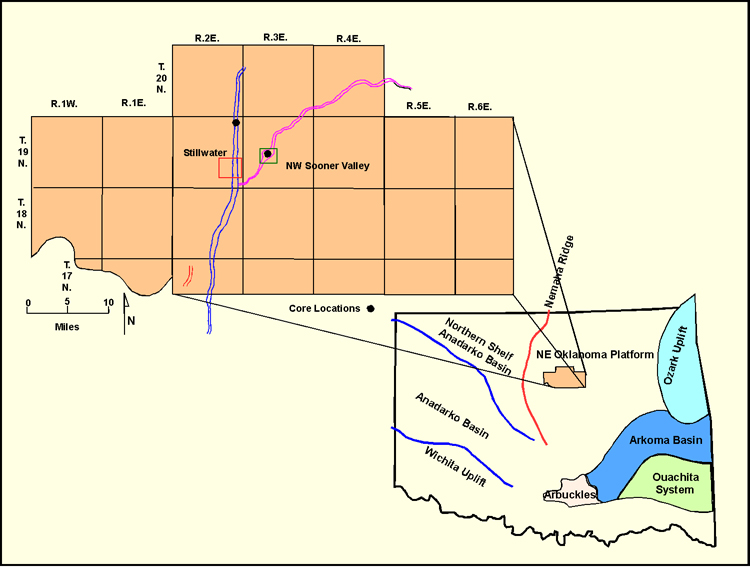
Figure 1. Index map for Payne County on the Northeast Oklahoma Platform, showing study area with (a) two major trends of Lower Skinner sandstone as valley-fill deposits, (b) area of Northwest Sooner Valley Field and of Stillwater Field, and (c) locations of two cores from the Lower Skinner within the paleovalleys.