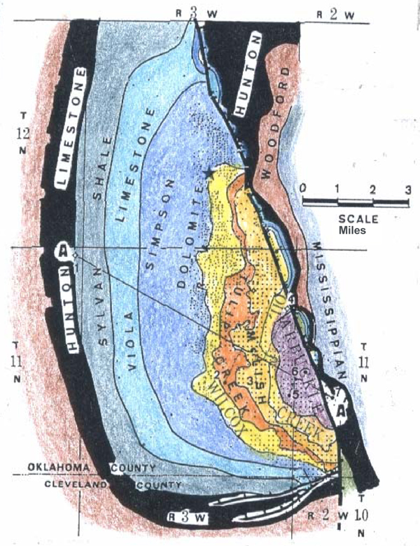
Figure 8. Pre-Pennsylvanian subcrop map of the Oklahoma City uplift (from Gatewood, 1970). This structure is a highly upthrown, pop-up reverse fault block bounded on the east by a fault of the Nemaha zone. Maximum throw is 2400 feet along a very straight, normal-vertical-reverse, down-to-the-east fault.