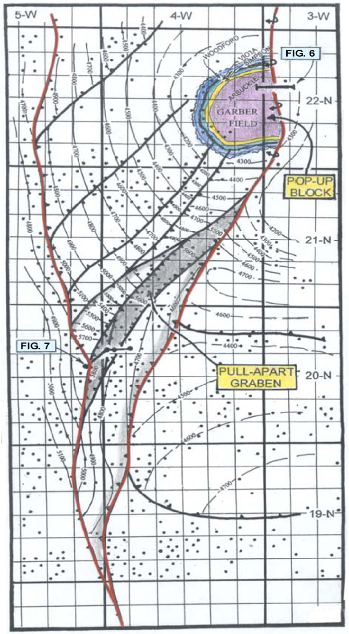
Figure 5. Structural contour map on top of Mississippian “lime” of the Garber area, north-central Oklahoma, showing a pop-up block and an associated graben. Every well (indicated by small dots) on this map has a value for the top of eroded Mississippian, providing very detailed control for delineating the fault pattern. The fault on the east is a down-to-the-east reverse fault. The stratigrahic section in the graben includes more than 600 feet of Lower Pennsylvanian and Upper Mississippian strata that were stripped from both flanking upthrown blocks.