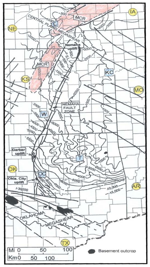
Figure 2. Structural contour map, on top of eroded Precambrian surface, of the area encompassing the Nemaha zone. The west-dipping, gentle homocline over much of eastern Kansas is little disturbed by the Nemaha zone. Contours in Kansas and Nebraska modified from Burchett et al. (1981); Nemaha fault trace in Kansas adapted from Berendsen and Blair (1992).